
2 Multispectral sensors and unmanned aerial systems for agricultural monitoring
Multispectral imaging technology relies primarily on specialised hardware and is based on the laws of spectroscopy and optics. Notably, every object possesses a unique spectral signature. A spectral camera separates reflected radiation into distinct spectral bands and records their intensity. As a result, the camera generates a separate monochrome (greyscale) image for each spectral channel. The actual analysis of this information is performed in GIS software by combining these images into true-colour or false-colour composites, as well as by calculating vegetation indices.
Various spectral bands are used to address different agricultural monitoring tasks:
- visible green (520-600 nm) – used to analyse vegetation health, assess vegetation cover, and estimate total biomass;
- visible red (630-690 nm) – corresponds to the zone of active chlorophyll absorption and is therefore used to evaluate plant health and delineate the boundaries between vegetation cover and soil;
- near-infrared (NIR) band (760-900 nm) – highly sensitive to plant condition and biomass, thus used to detect crop stress and assess productivity;
- short-wave infrared (SWIR) band (1550-2500 nm) – sensitive to moisture content in plants and soil;
- thermal infrared band – primarily applied to estimate the temperature of the underlying surface (Figure 7) [7].
Remote sensing systems are often classified according to their deployment platform, while the accuracy and spatial coverage of the acquired data depend on the sensor platform. Three primary levels are distinguished:
1) spaceborne (satellite) systems provide global coverage but are characterised by relatively low spatial resolution (typically 10 m per pixel or coarser) and are dependent on weather conditions;
2) airborne systems (UAVs) enable the acquisition of field-scale data with ultra-high spatial resolution, reaching a few centimetres per pixel, thereby providing an optimal balance between coverage area and level of detail;
3) ground-based systems are mostly used at the level of individual plants, leaves, or ears, and are primarily applied in scientific research, as well as in the development of reference spectral databases.
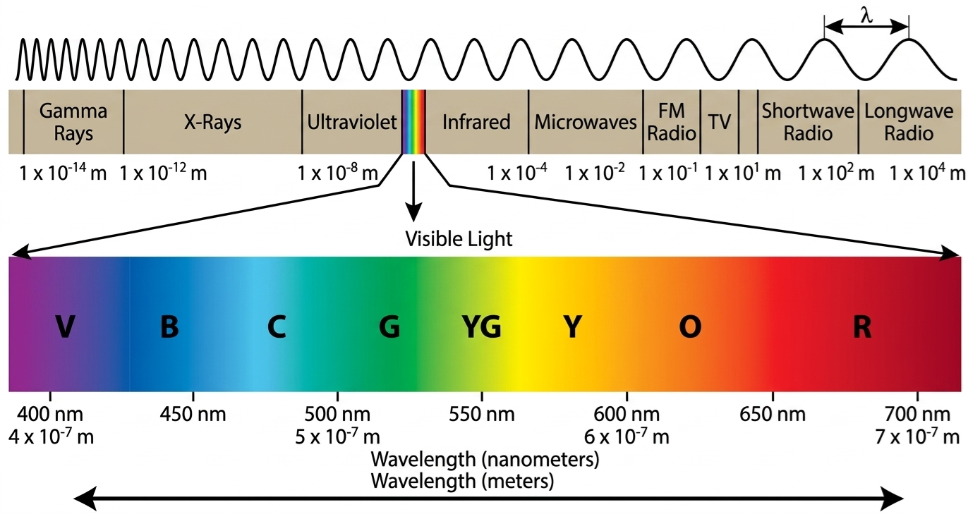
Figure 7 – Wavelength range of the electromagnetic spectrum [7]
Optical studies typically require verification. During this process, specialised spectral cameras mounted on UAVs are used for data validation and the detailed study of phytopathological processes. These are high-precision devices that enable the acquisition of not only images but also multichannel spectral data with high spectral resolution during aerial scanning.
A widely used example of multispectral cameras applied in agricultural monitoring is the FigSpec FS-50 series, including the FS-50/30 model (Figure 8) [8]. This camera operates in the range from 400 to 1000 nanometres. Its spectral resolution is approximately 3.5 nanometres, featuring up to 30 channels with a channel step of about 20 nanometres. Such cameras are used in precision agriculture to generate spectral maps and analyse plant health and stress conditions.
In the field of rapid aerial monitoring, integrated all-in-one solutions are becoming increasingly prevalent. One of the most common hardware suites for agricultural monitoring tasks is the DJI Mavic 3M (Figure 9) [9]. Its architecture includes a 20-megapixel RGB camera, which is used for visual inspection and the generation of high-resolution orthomosaics. Additionally, it features a multispectral module consisting of four 5-megapixel cameras that operate in the Green, Red, Red Edge, and Near-Infrared (NIR) bands. A built-in DLS (Downwelling Light Sensor) is used to record irradiance, ensuring the radiometric correction of multispectral data during processing. Furthermore, an RTK module provides centimetre-level georeferencing accuracy, significantly reducing the need for ground control points (GCPs).
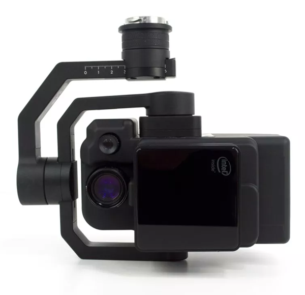
Figure 8 – FS-50/30 multispectral camera [8]
Specialised software suites are used to process multispectral data. Prominent specialised remote sensing software includes ENVI and ERDAS Imagine, which are powerful suites for spectral data analysis widely applied in agriculture, forestry, and environmental research. ArcGIS and QGIS are geographic information systems (GIS) used for spatial analysis, mapping, and the georeferencing of images to study areas. Matlab serves as a tool for mathematical modeling and computation, applied to develop custom image processing algorithms and implement machine learning methods. Photogrammetric processing and object-based image analysis are performed in software such as Pix4Dmapper, Global Mapper, and eCognition, which are used to seamlessly stitch raw images, generate accurate digital elevation models, and classify objects.
To address digital agriculture tasks, the numerous monochrome images acquired by UAVs require subsequent precise stitching and detailed analysis in specialised photogrammetric software, such as Pix4Dfields. The key features of this software primarily include:
- processing speed (owing to a specialised direct image-stitching algorithm, imagery covering hundreds of hectares can be processed within minutes);
- analytical capabilities (integrated tools for calculating vegetation indices, such as NDVI and NDRE, as well as for automatically delineating specific zones);
- data export and reporting (tools for generating maps of field conditions, including the identification of vegetation stress zones, the assessment of vegetation density, and the analysis of potential stress factors).
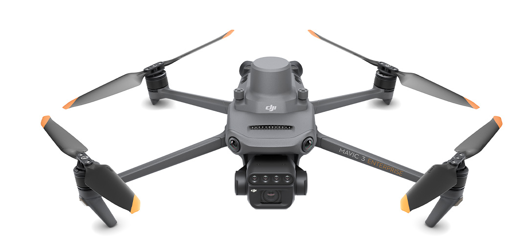
Figure 9 – DJI Mavic 3M drone [9]
Thus, modern agricultural monitoring constitutes a continuous technological chain, ranging from the recording of reflected radiation by a sensor to the generation of comprehensive crop condition maps in specialised software. It is the comprehensive use of these tools, along with the objective digital data derived from them, that enables agrocenosis management.